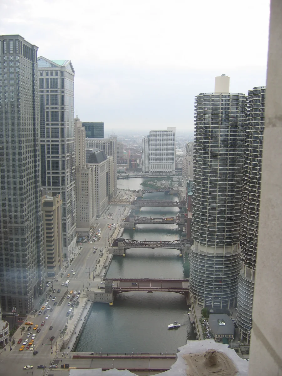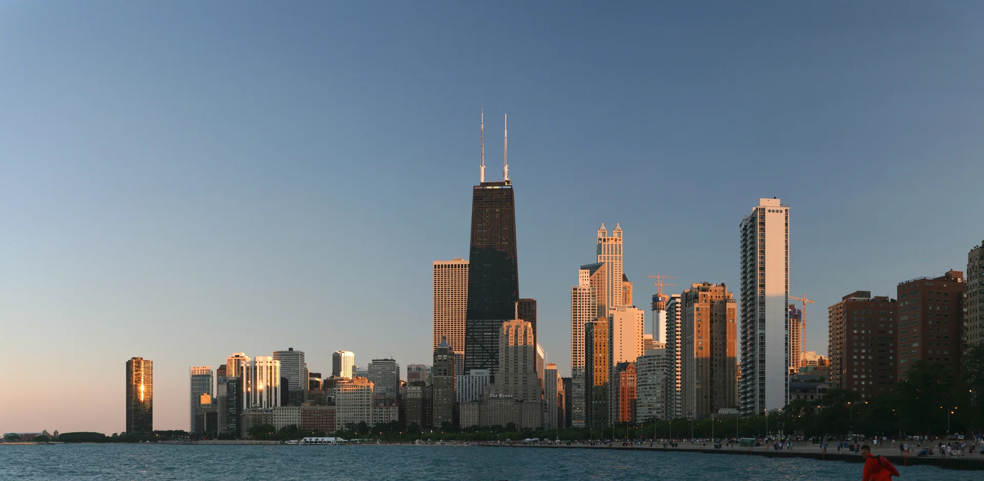
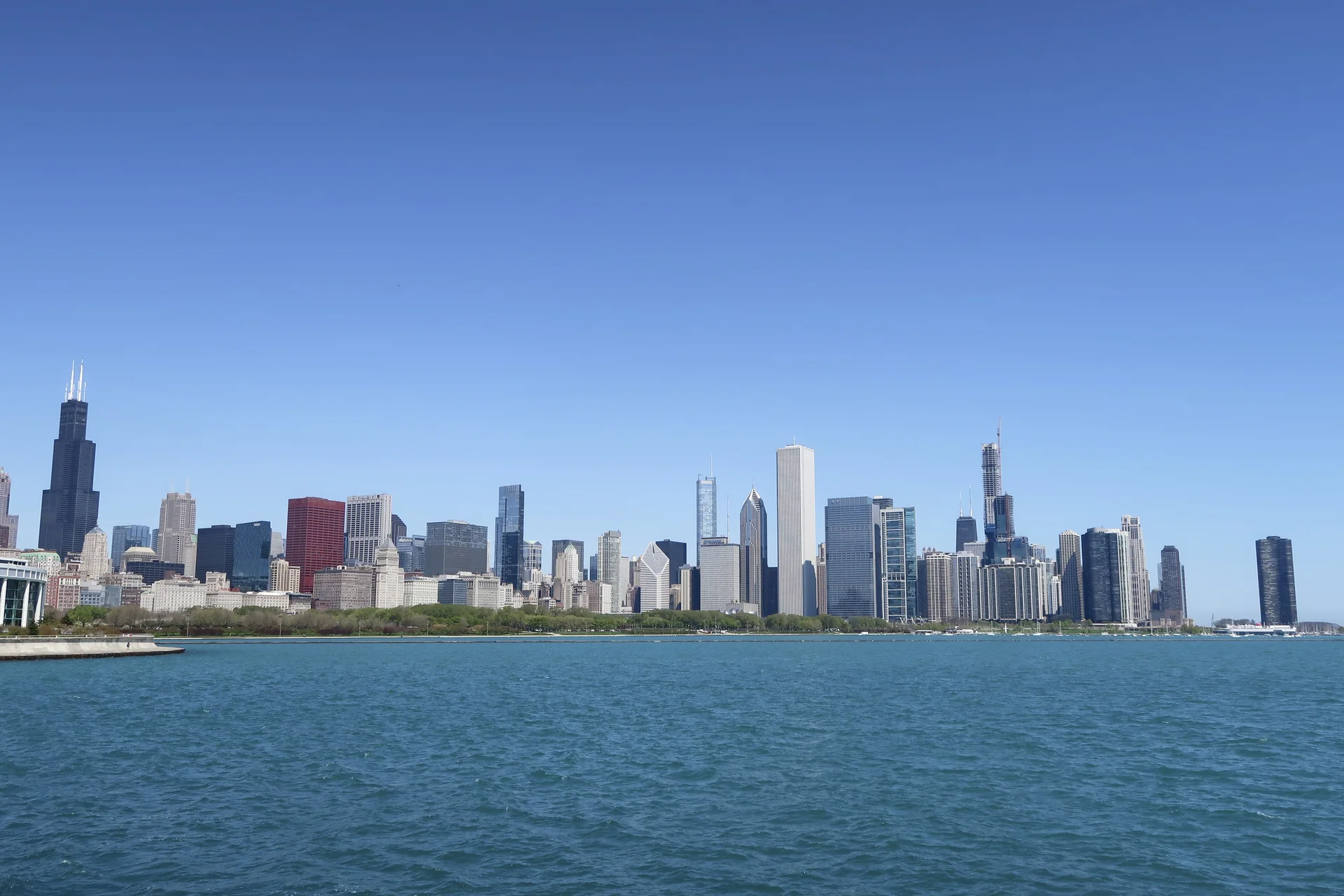
Chicago rewards a traveler who learns its shape before trying to conquer a list. The city is large, but it is not shapeless. Lake Michigan fixes the eastern edge. The Chicago River cuts through downtown and gives the skyline an interior waterfront. The street grid makes distance readable, while the elevated train and bus network turn that grid into a set of practical choices. Once those lines become familiar, Chicago feels less like a wall of attractions and more like a collection of neighborhoods connected by water, transit, parks, architecture, food, and music.
This guide is designed for a first visit of three or four days, with enough flexibility to work in any season. It does not prescribe current opening hours, ticket prices, or temporary schedules. Those details change, so confirm them with the venue or transit operator close to your visit. The aim here is to help you build days that make geographic sense, leave room for weather, and show more than a downtown highlight reel.
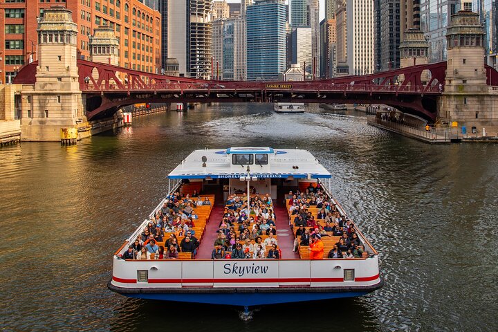
Chicago Architecture River Cruise
Experience the stunning beauty of Chicago on a captivating cruise along the historic Chicago River. This architectural tour takes you down the main br...
Begin with four orientation lines
Before choosing restaurants or museums, place four lines in your mental map. First is the lakefront, a long public edge with beaches, parks, museums, harbors, paths, and broad views back toward the city. Second is the river, which divides downtown into recognizable areas and creates some of Chicago’s strongest architectural perspectives. Third is State Street, the conventional east-west dividing line for street addresses. Fourth is Madison Street, the conventional north-south dividing line. You do not need to memorize the whole address system, but knowing that these lines exist makes signs and directions much easier to interpret.
Chicagoans often describe places by side, neighborhood, major intersection, or transit stop. A destination that looks close on a map may still involve a river crossing, a bridge approach, a large park, or several blocks under elevated tracks. Build a little slack into every move. The city is enjoyable at walking pace, and an unscheduled view from a bridge can be more memorable than arriving breathless at the next stop.
| Orientation line | What it helps explain | Useful planning habit |
|---|---|---|
| Lake Michigan | The eastern edge, lakefront parks, beaches, and changing weather | Check wind and temperature near the water separately |
| Chicago River | Downtown districts, bridge crossings, and architecture views | Plan at least one walk on both sides of the river |
| State Street | East and west address numbering | Use cross streets to estimate walking distance |
| Madison Street | North and south address numbering | Group nearby stops rather than zigzagging across downtown |
Choose a useful home base
There is no single best area for every visitor. Downtown is practical for architecture, museums, river access, and a short first trip. River North places restaurants and galleries close to many central attractions. The West Loop offers a different evening rhythm and easy access to former industrial streets. Lincoln Park and Lakeview can feel more residential while keeping the lakefront and transit within reach. Hyde Park provides a strong cultural and architectural base on the South Side, though the daily travel pattern differs from staying in the Loop.
Ask what you want to do before asking where to stay. If several early starts cluster around downtown museums and river tours, reducing morning travel may matter more than having the liveliest block outside your door. If the trip centers on neighborhood dining, music, or friends, a base closer to those plans may be worth the extra ride to the Loop. Do not choose by a skyline photograph alone. Check the exact address, nearby accessible transit options, late-evening route, and whether the surrounding streets match how you actually like to travel.
Day one: river, Loop, and lake
Use the first day to understand Chicago’s big physical systems. Begin near the river when your energy is high and the light gives the building facades some depth. Walk one bank, cross a bridge, and look back before moving on. From street level, the river reveals layers that a skyline view cannot: bridge houses, lower service levels, tower setbacks, masonry walls, glass reflections, and the way streets continue across movable bridges.
An architecture-focused river experience can be a valuable introduction when the narration is supplied by a qualified guide. The important point is not to collect building names. Listen for the reasons Chicago’s buildings look the way they do: fire, engineering, land value, structure, changing materials, transport, regulation, and ambitious clients. If a tour does not fit the schedule, the Riverwalk and bridge crossings still provide a coherent self-guided sequence.
Continue into the Loop, but resist the urge to move only from icon to icon. Notice the canyon effect beneath the elevated tracks, the shift in building age from one block to the next, and the civic interiors that offer a change of scale. Millennium Park and the surrounding lakefront campus make a natural transition from dense streets to open space. Public artwork deserves time and context; it is not merely a selfie checkpoint. Stand far enough back to understand how a work relates to movement, reflection, sound, landscaping, and the people using the space.
A strong first day moves from enclosed river corridor to street grid to open lake horizon. That sequence teaches the city’s scale without requiring an exhausting cross-town itinerary.
If weather permits, finish near the water. The lake can look oceanic, calm, metallic, green, or almost black depending on season and light. Temperatures and wind at the shore may differ from inland blocks. Carry a layer even when the downtown streets feel comfortable. At sunset, look back toward the skyline rather than searching only for a west-facing view.

Chicago in a Day Walking Tour: Food, History & Architecture
Immerse yourself in Chicago's rich history and vibrant culinary scene on this captivating walking tour. Discover the...

Chicago Lake and River Architecture Tour
An authentic Chicago tradition since 1935, this is the tour that started it all. This unique excursion tells the sto...

Chicago: Gangsters and Food Tasting Walking Tour
Taste some of Chicago's most iconic foods while walking through one of the Prohibition Era’s most fashionable and...
Day two: choose two neighborhoods, not six
Chicago’s neighborhood depth is one of its defining qualities, but a hurried circuit turns real places into scenery. Choose two areas that connect logically by transit or geography. Spend enough time to see a commercial street, a park or public institution, residential texture, and a meal or performance. Read local historical material before arriving so that architecture and murals are not stripped of their context.
A South Side pairing
Hyde Park can anchor a day built around cultural institutions, lakefront landscape, university architecture, and important residential work. Nearby Bronzeville offers essential Black history, music heritage, public art, and community institutions. These areas should not be collapsed into one generic South Side label. Plan specific destinations, learn the stories they preserve, and use respectful street-level photography. If Pullman is the priority, give its industrial planning, labor history, architecture, and national historical context their own time rather than treating the neighborhood as a quick backdrop.
A West and Northwest Side pairing
Pilsen and Logan Square can form another useful contrast, but they are not interchangeable creative districts. Pilsen is deeply shaped by Mexican American community life, murals, food, institutions, and activism. Logan Square has its own boulevard structure, residential architecture, music, restaurants, and independent businesses. Move with curiosity and restraint. A mural is a work with an artist and a context, not free design texture. A busy restaurant corridor is still part of a neighborhood where people live and work.
A North Side lake-and-stage pairing
Uptown, Edgewater, Andersonville, and Rogers Park offer lake access, music venues, theatres, immigrant food traditions, commercial streets, and residential architecture. Pick a manageable pair rather than rushing through all four. The lakefront changes character as it moves north, and the street grid reveals different scales of storefront and apartment building. Check event details directly with venues, because performance schedules change more quickly than evergreen planning advice.
Eat with geography in mind
Chicago’s food reputation is broader than a debate over pizza styles. A good food plan follows neighborhood histories and leaves room for the place itself. Mexican food in Pilsen or Little Village, South Asian food along Devon Avenue, Chinese food in Chinatown, Polish and Eastern European traditions on the Northwest Side, Black culinary history on the South and West Sides, and newer restaurant clusters all belong to different community stories. Research specific businesses and current status close to the visit rather than relying on an old best-of list.
For a short trip, use three complementary meal types:
- One destination meal that merits a reservation or deliberate journey.
- One neighborhood meal connected to the area you are already exploring.
- One flexible meal near the hotel or next activity, chosen for ease rather than prestige.
This pattern limits cross-town backtracking and makes room for weather or fatigue. It also reduces the pressure to turn every meal into an event. Chicago excels at bakeries, diners, cafeterias, taverns, markets, counter-service specialists, and neighborhood restaurants as well as formal dining. Verify accessibility, dietary needs, reservations, and current hours with the business.
Day three: build around your strongest interest
The third day should not repeat the structure of the first two. Choose one subject and let it organize the city. Architecture travelers might pair a focused building visit with a neighborhood walk and a quiet place to study details. Art travelers could balance a major museum with galleries, public art, or an artist-led neighborhood program. Music travelers should treat blues, gospel, jazz, house, classical music, and experimental scenes as living practices, not a single soundtrack.
Families may prefer a museum campus, park, beach, conservatory, or zoo day with fewer transitions. Sports travelers can build around a game while making time for the surrounding neighborhood beyond the stadium gates. Food-focused visitors can use markets, bakeries, specialty shops, and one planned dinner as a route. In every case, one strong interest produces a better day than stacking five unrelated headline attractions.
Still comparing Chicago First Visit River Neighborhoods Lake Planning?
Ask for tour ideas, hotel suggestions, or a simple trip plan that combines both.
Trip Helper
Architecture without landmark fatigue
Chicago architecture is most rewarding when you compare systems rather than count famous buildings. Look for a steel or concrete frame, a load-bearing masonry wall, a Chicago window, terra-cotta ornament, a modern curtain wall, a Prairie School horizontal composition, and a neighborhood greystone or bungalow. The comparisons make each stop more meaningful. Interior access varies, and many buildings remain active workplaces or residences, so follow posted rules and respect private space.
Music with context
Chicago’s music history includes migration, churches, clubs, warehouses, radio, record labels, community institutions, and technological invention. Read about the venue and tradition before attending. Buy a ticket through the venue’s current authorized channel. Arrive prepared to listen rather than treating a performance as background ambience. If an event is sold out or not scheduled during the trip, a museum, archive, record shop, or neighborhood history resource can still provide meaningful context without pretending to replace live music.
Make transit part of the plan
Public transit can be the most efficient way to move, but route conditions and service patterns change. Use the Chicago Transit Authority’s current tools for fares, accessibility, alerts, and arrival information. Some elevated stations require stairs; accessible alternatives may involve a different station or bus connection. At night, choose routes you are comfortable navigating, wait in visible areas, and keep normal city awareness without turning safety advice into fear.
Walking remains essential. Chicago blocks are generally readable, but long downtown blocks, bridge approaches, museum campuses, and lakefront paths can make distances feel different from a map. Comfortable shoes matter more than an aggressively optimized itinerary. Cycling can be useful on protected paths and the lakefront, though visitors should understand local rules, bike-lane conditions, and docking systems before setting out.
- Group stops on the same side of the river before crossing.
- Check whether a lakefront destination has a direct westward connection back to transit.
- Save the exact hotel address and a nearby major intersection offline.
- Allow extra time when a route depends on a bus transfer.
- Keep one indoor alternative for severe heat, cold, storms, or high wind.
Plan for Chicago weather honestly
Chicago is a year-round city, not a summer product with an inconvenient winter. Each season changes the experience. Summer supports beaches, festivals, patios, and long evenings, but heat and storms can alter a walking plan. Autumn can bring crisp light and strong temperature swings. Winter reveals architecture clearly and supports museums, food, performance, and seasonal outdoor experiences, but cold, ice, and wind require real preparation. Spring can move quickly between warm sun, rain, and lake-cooled air.
Use layers and protect the plan from a single point of failure. If a day depends entirely on a boat, rooftop, beach, or outdoor festival, choose an indoor alternative in the same part of the city. Avoid promising yourself that weather will improve by a specific hour. Check authoritative forecasts and service notices, then adapt. A slower museum morning or a long lunch is not a lost Chicago day.
Photography, murals, and people
Chicago is visually generous, which makes responsible photography important. Ask before making a close portrait. Do not block a sidewalk, station stair, bridge path, or business entrance. Photograph murals with the artist’s name and site context when available. Some interiors restrict photography, tripods, flash, or commercial use. Public space does not erase privacy, copyright, or respect.
For architecture, step back and keep vertical lines believable rather than forcing every building into a dramatic angle. For neighborhood scenes, include enough context to identify the place accurately. For the lake, watch the horizon. For food, keep the meal warm and the business moving. The best images often come from understanding what you are seeing rather than chasing a predetermined social-media frame.

Chicago River 90-Minute Architecture Tour
Be inspired by the captivating, visual art that is Chicago’s legendary architecture, and the exceptional architect...

Chicago River 45-Minute Architecture Tour from Magnificent Mile
Experience Chicago's legendary architecture and the exceptional architects who created this ever-changing legacy for...

Art Institute of Chicago Skip-the-Line Exclusive Guided Tour
The Art Institute of Chicago attracts nearly as many visitors as other leading galleries like the Met, Louvre & Brit...
A practical four-day variation
If you have a fourth day, use it to add depth rather than more downtown. The following structure keeps travel coherent:
- Morning: Choose one neighborhood institution, architectural site, park, or cultural collection.
- Midday: Walk a nearby commercial street and eat locally.
- Afternoon: Move toward the lake, a conservatory, or another landscape that changes the visual pace.
- Evening: Attend a performance, return to a favorite area, or leave the schedule open for rest.
Possible anchors include Pullman, Garfield Park Conservatory and its surrounding context, the far North Side lakefront, Hyde Park beyond a single museum, or a Northwest Side architecture and food route. Match the choice to current access and personal interest. Do not select a neighborhood merely because it has been described as undiscovered. People already live, organize, work, and create there.
Accessibility and a humane pace
Accessible travel requires route-specific information. Elevators, platform access, entrance locations, restrooms, seating, sensory conditions, and weather exposure vary. Check official resources and contact a venue when a detail is essential. A map’s shortest route may not be the easiest route. Build rest into the day before it becomes an emergency, and identify indoor public spaces where the group can pause.
A humane itinerary also improves the trip for travelers without declared accessibility needs. Limit major transitions. Sit by the river. Use a café as a planning stop rather than eating while walking. Let one museum wing be enough. Leave room to return to a place that surprised you. Chicago’s size can encourage a completion mindset, but the city is better understood through attention than accumulation.
Before you leave each morning
Use a short daily check instead of rebuilding the plan from scratch:
- Confirm the first destination’s current opening and entry information.
- Review transit alerts and the accessible route if needed.
- Check temperature, wind, precipitation, and lakefront conditions.
- Carry a charged phone, backup payment method, water, and a weather layer.
- Choose one optional stop that can be dropped without disappointment.
- Know the route back to the hotel before the final event begins.
This modest preparation creates freedom. When a bridge view holds your attention, a bookstore appears, a neighborhood event is underway, or the lake light changes, you can stay. The schedule has enough structure to protect the essentials and enough air to let Chicago become more than the sum of its bookings.
Follow the lines, then make the route yours
A first visit does not need to prove that you covered Chicago. It should leave you with a workable sense of the city’s form and several reasons to return. Begin with river, Loop, and lake. Give neighborhoods real time. Let architecture, food, music, parks, or art shape one day according to your interests. Use transit and the street grid as tools, not tests. Check changing facts with authoritative sources, and keep the plan flexible enough for weather and discovery.
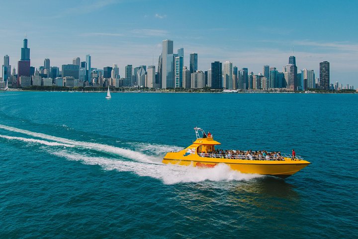
Lake Michigan 30 Minute Speedboat Ride
Enjoy Chicago’s iconic skyline with an exciting speedboat Tour on Lake Michigan. Departing from Navy Pier, the Lak...

Chicago Hop On Hop Off Open Top Bus Tour
Discover Chicago at your own pace with Big Bus. Travel aboard an open-top, double-decker bus and enjoy panoramic vie...

Chicago Gangsters and Ghosts Walking Tour
We are the original, top-rated Gangsters and Ghosts tour! Hear the tales of the ghosts, and gangsters, that haunt th...
Chicago Architecture River Cruise
Experience the stunning beauty of Chicago on a captivating cruise along the historic Chicago River. This architectural tour takes you down the main br...
The city will not resolve into one definitive view. From a river bridge it is structural and vertical. From the lakefront it is a long horizon. Under the L it is rhythmic and close. On a neighborhood commercial street it is social, specific, and constantly revised by the people who use it. Those views do not compete. They cross. Follow the lines, and the Chicago you find will be the one your route allowed you to notice.